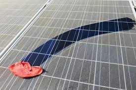
NREL Soiling Map
| Project ID | 15e1b647-f595-4176-a4d6-a981867b47ac |
|---|
NREL Soiling Map Datasets
DuraMAT Adjacent Project
Operational Field Studies
Category: PV Field Data
Recipient None (PI: Muller, Matthew)
Abstract NREL scientists and engineers have generated a map that highlights soiling parameters of fielded photovoltaic panels at 255 locations—either soiling stations or photovoltaic sites—across the United States. Losses are quantified by insolation-weighted soiling ratio (IWSR); an IWSR of 0.95 indicates 5% annual energy loss to soiling. This repository contains the underlying dataset supporting the soiling map.
